chatelus-malvaleix-plan-roussille-creuse-tourisme4-jpg-1024px.jpg
©default

Cities and villages of our territory

The territory of the Portes de la Creuse en Marche has 16 communes, all of which have a remarkable small heritage and we invite you to travel our small Creuse roads to discover them during a pleasant stay synonymous with meetings and authenticity.


Unavoidable

Tourist itinerary

Bonnat

Minimum altitude: 248 m / maximum: 515 m
Area: 45.79 km2
Name of the inhabitants: the Bonnachons and the Bonnachonnes

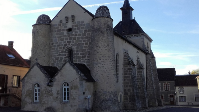
Bonnat is a county town of 1,329 inhabitants. Its Church of Saint-Sylvain built in the 13th century and fortified in the 14th century is classified as a historical monument. It has a magnificent carved wooden altarpiece dedicated to Saint-Sylvain protector of children. The commune of Bonnat is rich in a little heritage consisting of numerous washhouses, fountains, wooden and iron or granite crosses, locks… The rich environment of its preserved areas: forests, rivers, streams, paths and the varied landscapes make the happiness of lovers of the land.

Champsanglard

Commune of 233 inhabitants
Altitude: from 274m to 498m

The Latin origin of the name of the commune of Champsanglard, “Campus singularis”, and the presence of vestiges demonstrate a human presence dating at least from the Gallo-Roman period. It is bordered by the river “La Creuse”. Retained by a hydroelectric dam, La Creuse forms an artificial lake of 55 Hectares, the largest of the “Three Lakes” that follow each other on its bed. Part of the commune is classified as a Zone “NATURA 2000” for the richness and diversity of its flora and fauna, including the small “yellow-bellied toad”.

Châtelus-Malvaleix

Commune of 602 inhabitants
Castellucians and Castelluciennes
Altitude of the town hall: 417 m

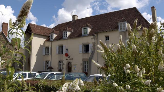
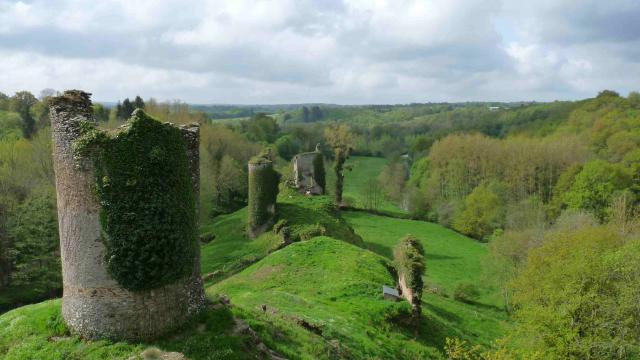
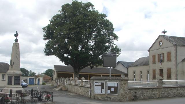
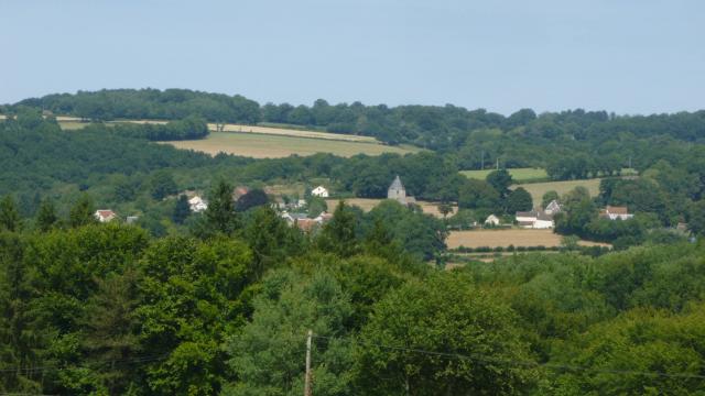
Since the Middle Ages, the town has developed at the foot of a smallfortified castle, “castellucium” in Latin. It was one of the strongholds of the Malval family, hence the name Châtelus-Malvaleix. The coat of arms of the commune gathers the arms of three families who were the lords before the Revolution: the Malesset, the Escoubleau and the La Roche-Aymon. From its past prosperity, Châtelus has preserved a rich built heritage with its remarkable houses, its town hall, its fountains and its wash houses…
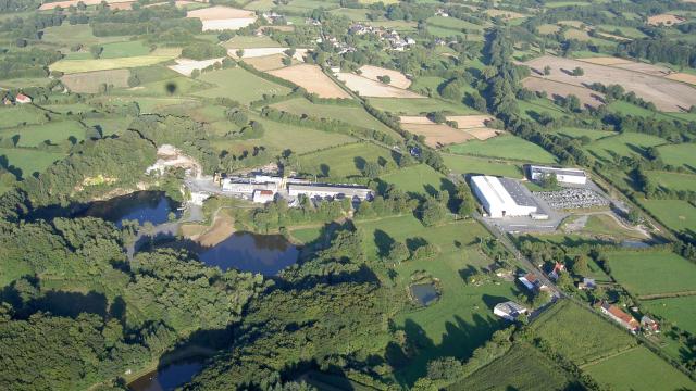
With two bodies of water and attractive tourist infrastructures, the commune offers many shops, public and health services and a dynamic associative life, all year round.

Genouillac

Located on the left bank of the La Petite Creuse River, halfway between Guéret and La Châtre, the commune of Genouillac is a dynamic rural town that has on its territory the rock wool factory “EUROCOUSTIC” of the Saint-Gobain firm. This commune owes its charm to theriver La Petite Creuse which a magnificent granite viaduct enjoins. It offers an admirable viewpoint and asserts itself as a place of history and architecture. In addition, the winding courses of La Petite Creuse and its streams are a delight for fishermen and walkers. The originality of this commune is also due to the different writings of Genouillac which have marked its history:
– GENOLLAC in 1212 (Letter of Innocent III)
– JENOILAC in the XIIth century (Cartulaire de Blessac)
– JANAILHAC in the XIVth century (Pouillé)
– GENOULHAC in 1571 (Archives of the castle of Sainte-Feyre)
– JENOULHIAC in 1601 (Terrier de Blessac)
– JANOILHAC and GENULLIACUM (Le Pouillé de Nadaud)
– GENOUILLAT or GENOUILLAC XIXth and XXth century
It is in 1971 that the ending C is adopted definitively to the name GENOUILLAC.

Jalesches

Commune of 85 inhabitants
The Jaleschois and the Jaleschoises
Altitude: 412 m

Inheriting a parish detached from Clugnat, the small village of Jalesches spreads over 8.5 km2. Its territory, rugged and wooded, will reveal its treasures to you at the bend of its paths. You will be able to appreciate its church, its calvaries and its fountains. A Roman road seems to have passed to the southwest of the Bourg, from the hamlet of Lavaud to Marcillat, where you can still distinguish some traces of this ancient road, located in the shade of the undergrowth. This small rural township remains punctuated by traditions with its preserved spaces and its rural flora.

La Cellette

Commune of 270 inhabitants
Les Cellettois et les Cellettoises
Altitude: 350 m

La Cellette, a rural commune in the Bas-Berry region, included in the department of Creuse in 1792, is at the crossroads of the provinces of Berry, Limousin, Bourbonnais and Auvergne. Between meadows and woods, you can follow the paths of the pilgrims who went from Déols to the Abbey of Prébenoît de Bétête or the masons who would build the prestigious buildings of the capital. With less than 10% of the land plowed, you will discover water, stone and greenery, enough to satisfy your senses, your curiosity, your love of nature and restore yourself.

La Forêt du Temple

Commune of 150 inhabitants
Les Forestiens et les Forestiennes
Altitude: 395 m

La Forêt du Temple has been inhabited since ancient times. With the arrival of the Templars, the soldier monks, the first written historical record is available. In the cartulary of the Abbey of Aubepierre, we find this sentence: “Domus Fratum de Templo la Forêt (1185)”. The Knights of the Temple, established in 1185, had built their commandery and a chapel there. If, The Forest of the Temple knew a period of prosperity during its foundation. It was less so thereafter since it ended up being removed in 1836 from the map of municipalities and annexed to the commune of Mortroux. It was only in 1883 that, thanks to the action of the dedicated teacher, François Ravaud, La Forêt du Temple regained its administrative identity.

Linard-Malval

Commune of 245 inhabitants
Altitude: 320 m

Located in North Creuse not far from Berry, Linard is a small rural village that takes its name from the cultivation of linen. The main economic activity is cattle breeding. The Fayolle stream crosses the village on both sides before flowing into the river. The Petite Creuse which borders the whole lower part of the commune. This small stream has kept its flora and fauna practically intact. By taking the paths and especially the Gallo-Roman way, you can contemplate a beautiful green and very hilly countryside with bucolic and soothing landscapes.

Lourdoueix Saint Pierre

Commune of 804 inhabitants
Lourdoueisiens et les Lourdoueisiennes
Altitude: 375 m

The name of the commune of Lourdoueix-Saint-Pierre is said to come from the Occitan word “Lordoir” which means order. On the border of the Indre, next to Aigurande, the commune presents 3 very different landscape units: to the west, the steep valley of La Petite Creuse overhung by the village of Lignaud with traces of a very ancient historical past; to the east, a plateau of crops largely open to the Berry; between the two, a tight and wooded bocage very hilly, crisscrossed by numerous streams with beautiful viewpoints. The habitat is spread out in numerous villages, some of them very large, such as Lignaud or Les Chaumes.
An astonishing number of village crosses and paths, made of stone, wood or iron, dot the commune. To note an unusual fact: the commune has two War Memorials, that of the town and that of the hamlet of Villechiron.The writer George Henry (1896-1960), whose real name was Henriette Jeanne Brunet, regularly stayed in the hamlet of Piodon.

Méasnes

Commune of 564 inhabitants
Les Méasnois et les Méasnoises
Altitude: 370 m

Located in the extreme north of the Creuse department and the Limousin region, Méasnes is a charming village of 564 inhabitants overlooking the Creuse valley on the southwestern slope of the Aigurande (Indre) hill. At an altitude of 370 m, the village offers a magnificent panorama over the mountains of the Marche, notably the Puy des Trois Cornes, the heights of St Vaury and the Maupuy which are close to Guéret.the main economic activity of this commune is agriculture generally based on the breeding of Limousin and Charolais cows. Its proximity to the town of Aigurande allows it to benefit from all the services and shops of its neighboring Berrichonne.Its built heritage is quite rich with the presence of several castles, fortified houses and manor houses that bear witness to a very interesting historical past. Numerous ponds and streams recall the proximity of the sources of small rivers (Gargilesse and Bouzanne) feeding the Loire basin. The omnipresent granite in the buildings testifies to the knowledge of the extraordinary builders that were the masons of the Creuse

Mortroux

The commune of Mortroux is a rural commune bounded by 6 communes; those of: Lourdoueix- Saint-Pierre to the west; Moutier-Malcard to the east, La Forêt du Temple and Nouziers to the north; Malval and

Linard to the south. By ordinance of June 20, 1836, the com-mune of La Forêt du Temple had been suppressed and its territory had been joined to that of Mortroux; but in 1883, it was again erected as a commune.Today, the commune of Mortroux comprises a town and about ten hamlets. It covers a territory of 1 328 ha. On the coat of arms of the commune adopted in 2004, the gules and the pots remind that Mortroux was a village of famous potters. The ermine chief of this coat of arms evokes the coat of arms of the Limousin.
The village has kept the memory of its artists, with the presence of beautiful pottery used in finials adorning several roofs of the village.

Moutier-Malcard

Commune of 531 inhabitants
The Moutiérois-Malcardais and Moutiéroises-Malcardaises
Altitude: 375 m

The name of the commune comes from the Latin Monastérium in the 12th century, then Monastério Malecare in the 15th, then Moustier Mallecare in 1751, the name of the lord from whom the monastery depended: Willelmus Malachara. A vicarage was founded in 1471 in the church of Moutier-Malcard by Antoine de Blanchefort, Sawyer of Bois-Lamy. In the past, the commune had 3 feudal castles: that of Moutier and that of the Plaid which are completely demolished, and that of Bois Lamy of which only the circular keep remains. Today, Moutier – Malcard is a small and pleasant rural commune with a school, a grocery store and a café.

Nouziers

Commune of 234 inhabitants
The Nouziérois and the Nouziéroises
Altitude: from 342 m to 466 m

A pleasant commune located in the North of the Creuse department and bordering the Indre department, it is also located on the “first foothills” of the Massif Central, offering a green, hilly and wooded landscape. The paths are still lined with “bouchures” which protect the walker from the heat or the bad weather. However, there are only a few walnut trees left, which seem to have given their name to the commune (Nouziers is derived from the Latin “nucarium” which means walnut tree). Nouziers is a dynamic commune with an important associative life and animations which welcome each year many visitors like the 24 hours Solex for the pentecost or the Christmas market which takes place the last Sunday before Christmas.

.

Roches

Roches is a commune of character, marked by its important religious heritage. Located a few hundred meters from the town, the remarkable site of La Péricholle characterizes the commune. You will discover there the Statue of the Virgin which surmounts a bank of rocks, nicknamed the Pierre aux Fées, and its small chapel, called Notre-Dame de l’Espérance as well as a remarkable panorama on the Valley of La Petite Creuse and the Berry.

Saint-Diziers-les-Domaines

Commune of 190 inhabitants
Les Bragards et les Bragardes
Altitude: 340 m

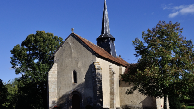
Charming little rural commune, St Dizier-les-Domaines is located in a green setting and offers a bucolic setting. Near the village of Bois-sières flows the Petite Creuse, a river appreciated by fishermen. The church of the commune dates from the 13th century and has superb paintings from the late 17th-early 18th century, which decorate the choir and the nave.

.

Tercillat

Commune of 163 inhabitants
The Tercillatois and the Tercillatoises
Altitude: 394 m

This small rural commune is located in the north of the Creuse department, on the border of the Indre. Coming from Berry, one discovers the Marchois landscapes and the foothills of the Massif Central.In 1789, the territory of Tercillat was split in two with the creation of the commune of Viviers, this until 1833

Close